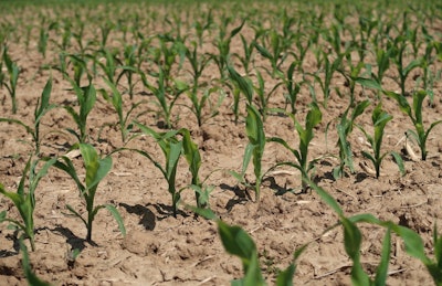
Recent widespread precipitation brought significant relief to drought-stricken agricultural regions across the United States, according to the latest U.S. Drought Monitor report. Heavy rainfall, exceeding 1 inch in many areas, led to notable improvements in the High Plains, Northeast, and parts of the Midwest and Southeast. However, below-normal precipitation in other areas resulted in the expansion or intensification of drought.
The U.S. Drought Monitor is jointly produced by the National Drought Mitigation Center at the University of Nebraska-Lincoln, the United States Department of Agriculture (USDA), and the National Oceanic and Atmospheric Administration (NOAA).
Regional drought conditions:
- High Plains: This region experienced substantial relief, with areas from North Dakota to northern Nebraska receiving 2 to 10 inches of rain, representing 400% to 600% above normal weekly precipitation. This led to widespread improvements in moderate to extreme drought (D1-D3) in the Dakotas and Nebraska. Northern Wyoming and eastern Kansas also saw improvements. Conversely, dry conditions led to an expansion of extreme drought (D3) in southwest Nebraska and western Wyoming, and moderate to severe drought (D1-D2) expanded in southern Wyoming and Colorado.
- Midwest: Above-normal precipitation (3 to 6 inches) in parts of Minnesota, Iowa, Missouri, Illinois, Indiana, and Kentucky led to moderate drought (D1) improvements in Minnesota, Missouri, and western Illinois. However, below-normal rainfall in much of Wisconsin, parts of Ohio, and northern sections of Minnesota, Illinois, and Indiana resulted in the expansion of moderate drought and abnormal dryness in northern and eastern Illinois and western Indiana.
- Southeast: Heavy rains, with totals 1 to 8 inches above normal, significantly improved conditions. Severe drought (D2) was removed from northern Virginia and eastern North Carolina, with improvements to moderate drought (D1) and abnormal dryness (D0) across much of Virginia. Coastal Carolinas also saw D2 improvements. However, dry conditions in the Florida Peninsula led to an expansion of moderate to extreme drought (D1-D3).
- South: While much of the region saw warmer temperatures, precipitation varied. Arkansas, Louisiana, and Mississippi are now free of drought and abnormal dryness. Moderate drought (D1) was removed from eastern Tennessee, and abnormal dryness (D0) was removed from Mississippi. Much of the beneficial rain fell in areas already free of drought.
- Northeast: Significant rainfall, with 3 to 8 inches in parts of West Virginia, Maryland, Pennsylvania, and New Jersey, led to broad improvements. Severe drought (D2) was removed in West Virginia and eastern Pennsylvania, and moderate drought (D1) was eliminated in Maine, northeastern Massachusetts, New York, and New Jersey.
- West: Cooler temperatures dominated. Beneficial precipitation improved moderate to extreme drought (D1-D3) in eastern New Mexico and trimmed moderate to severe drought (D1-D2) in western Utah. However, below-normal precipitation resulted in the expansion of exceptional drought (D4) in southwestern New Mexico and moderate drought (D1) in northern Montana.
Looking ahead
The forecast for May 20–24, 2025, indicates a low-pressure system will bring rain and thunderstorms to the Mississippi and Ohio Valleys, moving to the Mid-Atlantic and Northeast. The Northwest may see modest precipitation. Hot temperatures are expected across the southeastern U.S., particularly in southern Texas and the Florida Peninsula. Cooler temperatures are forecast for the northern tier, eventually moderating temperatures in the South. The Southwest is expected to see above-normal temperatures.
The Climate Prediction Center’s 6-10 day outlook (valid May 25–29, 2025) favors above-normal precipitation for most of the U.S. Below-normal precipitation is anticipated in parts of the Midwest, from northern Minnesota to northern Michigan. Above-normal temperatures are forecast for Hawaii, much of the West, and along the Gulf Coast, while below-normal temperatures are favored from the central Plains to the Northeast.