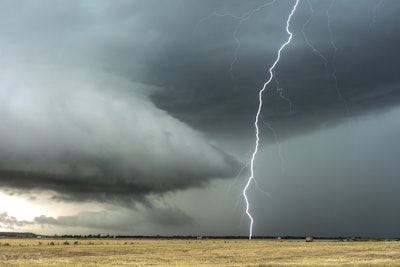
The U.S. Drought Monitor, produced through a partnership between the National Drought Mitigation Center, the U. S. Department of Agriculture (USDA), and the National Oceanic and Atmospheric Administration (NOAA), reported significant weather impacts across the country this week. A series of severe weather events have significantly impacted agricultural operations across various regions in the United States. A front moving from the Northwest to the Great Basin brought rain and higher-elevation snow, while also causing extreme weather and rain across the Plains and Lower Mississippi Valley. Another front from the southern Plains to the Great Lakes triggered severe weather and thunderstorms from Texas to New York. Meanwhile, a sub-tropical upper-level high over Mexico led to record or near-record warmth in Texas.
Regional impacts
Northeast: Precipitation varied, but totals were below normal for most of the region. Abnormal dryness expanded in northern Maine due to precipitation deficits and declining groundwater and soil moisture. Temperatures were 2 to 10 degrees F above normal across the region.
Southeast: Temperatures were up to 10 degrees F above normal, particularly in parts of Virginia. Northern Alabama, Georgia, and parts of North Carolina received heavy rainfall, improving drought conditions. However, dryness expanded in western Alabama and central South Carolina. Severe drought was introduced in parts of the Florida Peninsula due to significant precipitation deficits.
South: Dry conditions continued in the western South, while heavy precipitation fell in eastern parts, particularly Arkansas, Tennessee, and eastern Texas and Oklahoma. This led to improvements in drought conditions in these areas. Conversely, conditions worsened in eastern Oklahoma, Texas, and Mississippi. Temperatures ranged from 2 to 10 degrees F above normal.
Midwest: Much of the Midwest saw above-normal precipitation, especially in the western and southern regions. This alleviated longer-term precipitation deficits and improved soil moisture and streamflow impacts. However, portions of Michigan and Ohio remained drier than normal.
High Plains: Heavy rainfall in North Dakota and eastern portions of the region prevented further degradation. Improvements were seen in south-central Kansas and parts of Nebraska. However, dry conditions persisted in eastern Colorado and parts of Nebraska and Kansas.
West: Most of the West remained stable, with below-normal temperatures and precipitation falling in northern areas, particularly Washington and Montana. Improvements were noted in Montana, while dry conditions led to deterioration in the interior of Washington.
Caribbean and Pacific: No changes were reported in Puerto Rico. The U.S. Virgin Islands saw heavy rainfall, improving well levels. Dry conditions persisted across much of Hawaii, with some areas seeing improvements while others degraded.
Looking Ahead: The next five days are expected to bring showers and thunderstorms, particularly across Texas and Oklahoma, with potential heavy rainfall. The Gulf Coast will continue to experience hot and humid conditions, while relief is expected midweek as a cold front moves in. The Climate Prediction Center's outlook for June 2-6 favors above-normal precipitation along the West Coast, southern Plains to the East Coast, and much of Alaska, with below-normal precipitation in the interior West and Hawaii. Warmer temperatures are forecast for most of the contiguous U.S. and Hawaii, with cooler temperatures expected in Alaska and parts of the Southeast.


